http://www.dailynews.co.th/
วันอังคารที่ 24 กรกฎาคม พ.ศ. 2555
Article of Dailynews, Thailand
Disaster Education Seminar in Lampang (Conducted on 5-6 July, 2012) was introduced by Dailynews on 20 July.
http://www.dailynews.co.th/
http://www.dailynews.co.th/
วันอังคารที่ 17 กรกฎาคม พ.ศ. 2555
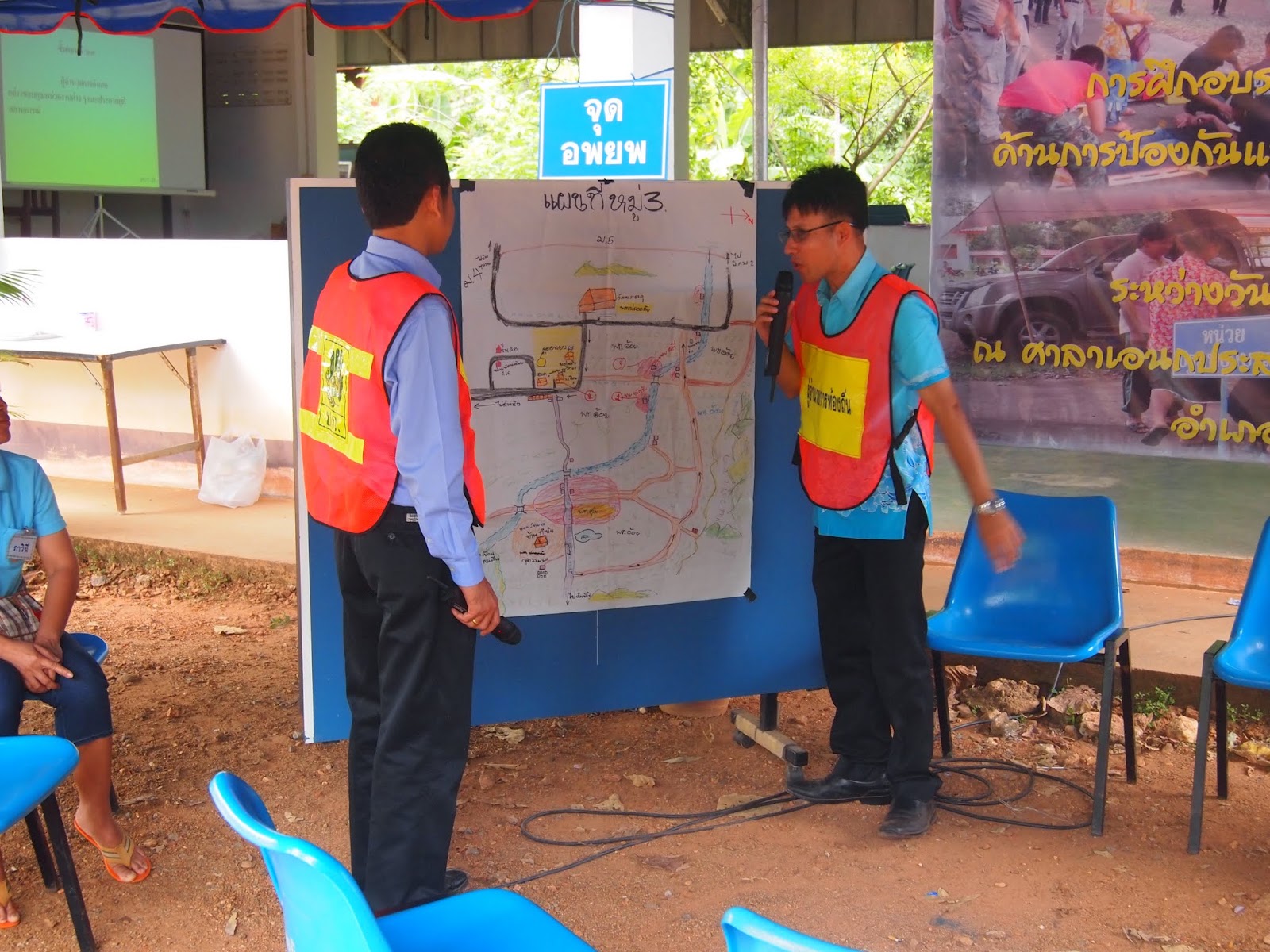
CBDRM Workshop in Nikom Krasiew Sub-District, Danchang District,Suphan Buri Province
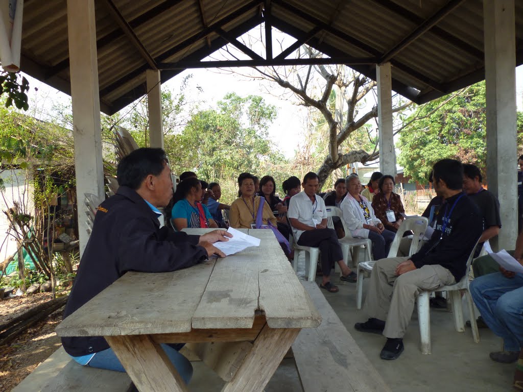
On 28-29 June, 2012, 2days CBDRM Workshop was conducted in Nikom Krasiew Sub-District, Danchang District,Suphan Buri Province.
People from the 3 villages, Ta Deua (No.3), Pu Wai (No.4) and Wang Nor Mai (No.5) prepared the Early Warning and Evacuation Plan through the Workshop. After completion of the planning, Village Head will submit the plan to DDPM Provincial Office.
On the 2nd day, Evacuation Drill Demonstration was conducted around Sub-District Office. An elementary school nearby Sub-District Office joined it.
For further pictures, please visit our Facebook page or google+ page.
Find us on Facebook
Find us on Google+
People from the 3 villages, Ta Deua (No.3), Pu Wai (No.4) and Wang Nor Mai (No.5) prepared the Early Warning and Evacuation Plan through the Workshop. After completion of the planning, Village Head will submit the plan to DDPM Provincial Office.
On the 2nd day, Evacuation Drill Demonstration was conducted around Sub-District Office. An elementary school nearby Sub-District Office joined it.
 |
| Lecture about the concept of CBDRM |
 |
| Preparation of Disaster History and Village Calendar |
 |
| Presentation of Risk Area in Village 4 |
 |
| Explaining about the steps of disaster management in community level |
 |
| Evacuation Drill Demonstration |
 |
| Evacuation Drill Demonstration (School Children are Evacuating) |
 |
| Evacuation Drill Demonstration (Closing Ceremony) |
For further pictures, please visit our Facebook page or google+ page.
Find us on Facebook
Find us on Google+
วันพฤหัสบดีที่ 12 กรกฎาคม พ.ศ. 2555
CBDRM Workshop in Ko Nong Village and Kor Thung Village, Lamphun Province on 5-8 March, 2012
On 5 to 8 Mar, 2012, CBDRM (Community Based Disaster Risk Management) Workshop was held at Ko Nong Village and Ko Thung Village in Ko sub-district, Li District, Lamphun province.
Early warning and evacuation plan including community risk map was prepared through the workshop.
Early warning and evacuation plan including community risk map was prepared through the workshop.
Disaster Prevention Criteria Bureau had a lecture about the relationship between rainfall amount and river water depth and simulated flood hazard.
To test the early warning and evacuation plan, Evacuation Drill was conducted on the last day.
For further pictures, please visit our google+ page.
Find us on Google+
To test the early warning and evacuation plan, Evacuation Drill was conducted on the last day.
 |
| Writing Community Disaster History |
 |
| Introduction of Hazard Mapping for Lao Trainee |
 |
| TF-5 Introduced the Hazard Map Based on Flood Simulation as Potential Flood Risk |
 |
| The Existing Risk shown on the Risk Map in Kor Thung Village |
 |
| The Village Headman of Kor Thong Village explaining Community Action Plan |
 |
| The Village Headman of Ko Nong Village explaining Community Action Plan |
 |
| The Facilitator Introducing the Warning Information Dissemination System in Each Village |
 |
| The Early Warning and Evacuation Plan Prepared Through This Workshop |
 |
| An Emargency Meeting for Flood Response (Evacuation Drill) |
Find us on Google+
วันพุธที่ 11 กรกฎาคม พ.ศ. 2555
CBDRM Workshop in Chowfa Village, Lampang Province on 20-23 February, 2012
On 20 to 23 Feb, 2012, CBDRM (Community Based Disaster Risk Management) Workshop was held at Chawfa Village and Mae Jok Fah Village in Thung Pueng sub-district, Jaehom District, Lampang province.
Early warning and evacuation plan including community risk map was prepared through the workshop. Chawfa Village and Mae Jok Fah Village could not contact each other in emergency since there is no wireless communication system. To implove the early warning system, JICA supported to install rain gauges and wireless communication system in Chawfa Village and Mae Jok Fah Village.
Early warning and evacuation plan including community risk map was prepared through the workshop. Chawfa Village and Mae Jok Fah Village could not contact each other in emergency since there is no wireless communication system. To implove the early warning system, JICA supported to install rain gauges and wireless communication system in Chawfa Village and Mae Jok Fah Village.
To test the early warning and evacuation plan, Evacuation Drill was conducted on the last day. The school students and teachers from Chow Fa Primary School and Mae Jok Fah Primary School.
The workshop was facilitated by facilitators from DPM (Disaster Prevention and Mitigation) Regional Center No.10 (Lampang), DPM Lampang provincial office, DPM Lamphun provincial office and JICA Expert team. JICA Expert team had a session to introduce the early warning system based on scientific approach.
The workshop was facilitated by facilitators from DPM (Disaster Prevention and Mitigation) Regional Center No.10 (Lampang), DPM Lampang provincial office, DPM Lamphun provincial office and JICA Expert team. JICA Expert team had a session to introduce the early warning system based on scientific approach.
 |
| Quiz of Terms and Definition in Disaster Management |
 |
| Community event and Hazard Calendar |
 |
| Drawing Hazard and Vulnerability Map |
 |
| Discussion on Community Structure for Disaster Risk Management |
 |
| Preparing Action Plan in the Community |
 |
| Conducting Table Top Exercise with School Teachers |
 |
| Existing Risk and Available Resources in the Village Shown on the Hazard and Vulnerability Map. This is a new approach of Table Top Exercise with 3D. |
 |
| Evacuation Route Map Temporarily Posted at the Main Street |
 |
| Village leader contacting to the municipality by walky-talky system which was installed by JICA (in the Evacuation Drill) |
 |
| Group Photo of the All Participants |
For further pictures, please visit our google+ page.
สมัครสมาชิก:
ความคิดเห็น (Atom)